Historic Floods Throughout the Years in Harpers Ferry

On June 4, 2018, curious onlookers gathered in Shenandoah Street to watch waves rolling in against the shuttle stop pavilion. Families of Canada geese swam back and forth over the inundated sidewalks. With the Potomac River gauge reporting floodwaters at 21.74 feet, and the rivers nudging their way into town, it seemed like an extreme situation.
By Harpers Ferry standards, that was nothing.
For some perspective, here are some quick Harpers Ferry flood facts:
Highest Flood: 1936
Potomac River level: 36.5 feet
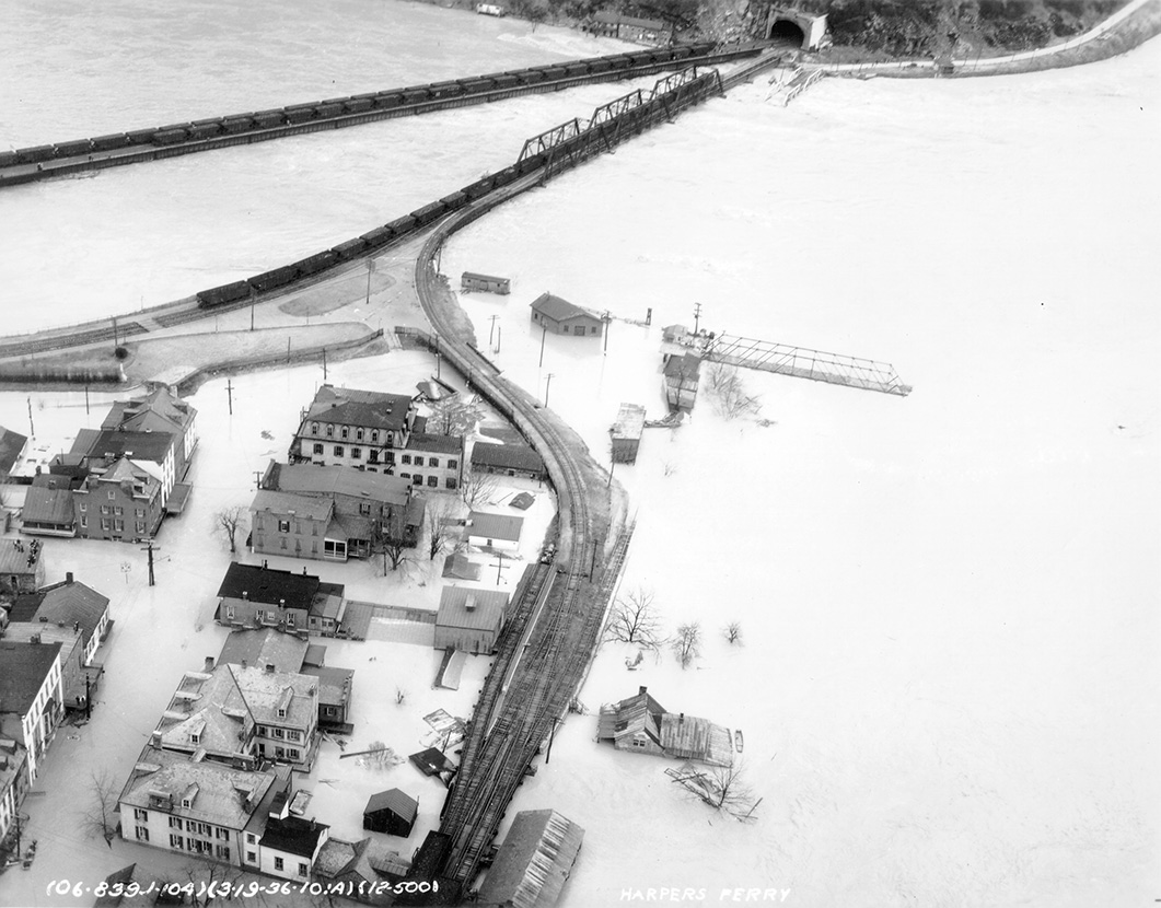 |
| HF-1724, Historic Photo Collection, Harpers Ferry National Historical Park. |
This flood severed two of Harpers Ferry’s major lifelines: both the Bollman Bridge over the Potomac (in the photo, a remnant is barely visible on the Maryland shore), and the Shenandoah Bridge (again, look for the remnant) were swept away as if they were toys. The destruction to shops and other businesses in Lower Town was extensive. Coming in the middle of the Great Depression, recovery after the flood would be painstakingly slow.
Second place: 1889, 34 feet
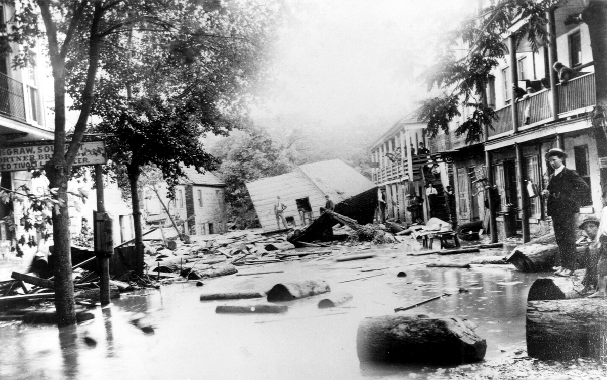 |
| HF-0082, Historic Photo Collection, Harpers Ferry National Historical Park. |
Third place: 1942, 33.8 feet
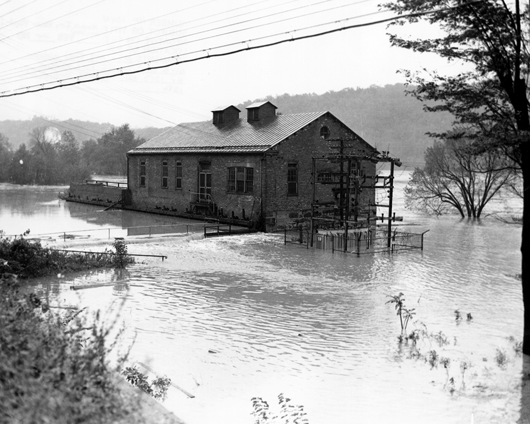 |
| HF-1344, Historic Photo Collection, Harpers Ferry National Historical Park. |
Deadliest Flood: 1870
Potomac River level: 30 feet*
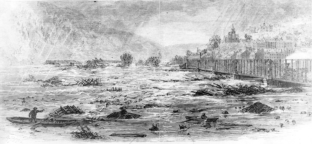 |
| HF-347, Historic Photo Collection, Harpers Ferry National Historical Park. |
Swift-rising floodwaters claimed more than forty lives around Harpers Ferry during this tragic autumn flood. After a season of drought, the sun-hardened soil of the Shenandoah Valley was hit with eight inches of rain in just forty-eight hours. As the river swept north toward Harpers Ferry, it swelled to monstrous proportions. Residents of Virginius Island found themselves trapped, cut off from the rest of the town and at the mercy of the river. Many of the homes and industries on the island were swept away--a devastating blow to the town’s attempt to recover after the Civil War, which had just ended five years earlier.
*Approximate level, based on reports at the time. Official recording did not begin at Harpers Ferry until 1877.
Earliest Flood: 1748
Potomac River level: unknown
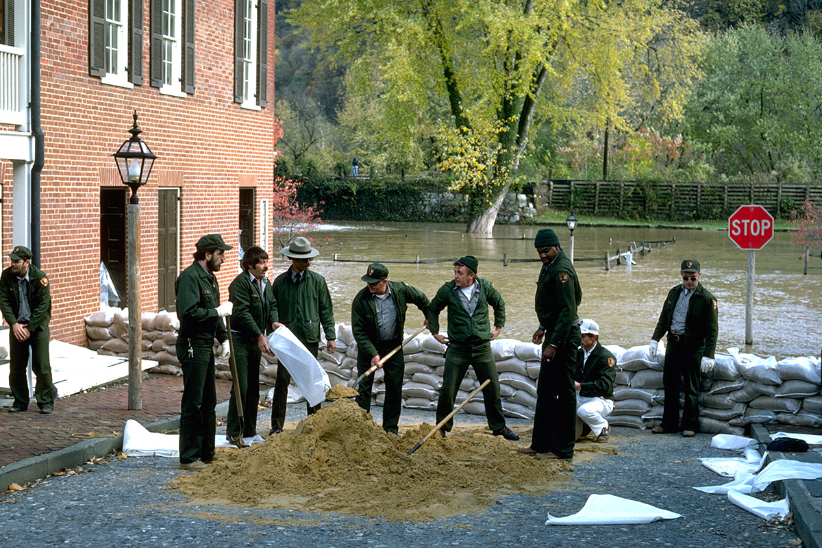 |
| NPS staff use sandbags to protect historic resources in Harpers Ferry, 1985 (29.8 feet). By David T. Gilbert. |
Legend says that shortly after Robert Harper, the town’s namesake, took up residence in a cabin along the river, floodwaters chased him up the hill. He would ultimately build his home a healthy height above the floodplain. Clearly this was not the first flood the Confluence experienced, but it is the first mentioned by settlers of European descent.
Most Recent Major Flood: 1996
Potomac River level: 29.4 (January) and 29.8 (September)
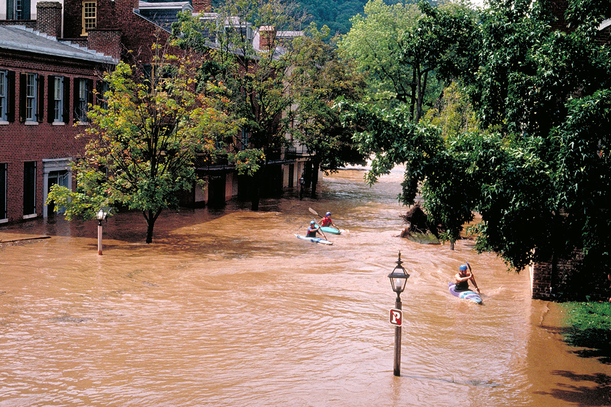 |
| September 1996 Flood, by David T. Gilbert. |
The National Weather Service classifies a Major Flood of the Potomac at Harpers Ferry to be 24 feet or higher. In 1996, Harpers Ferry experienced two “hundred year” major floods in a single year. The first occurred in winter, following the melt of a blizzard that dumped more than two feet of snow on the river valleys. The autumn flood was sparked by the remnants of Hurricane Fran--a deadly storm that, at the time, was one of the ten costliest hurricanes ever experienced in the United States.
How high is a flood?
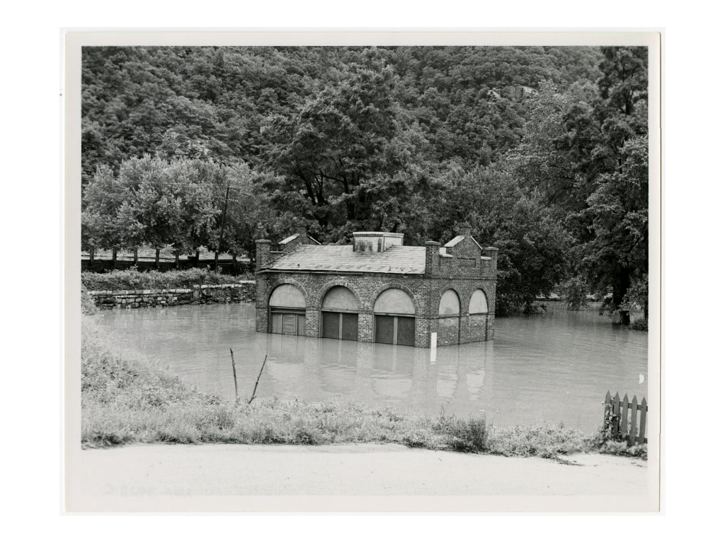 |
| John Brown Fort during the 1972 flood (29.7 feet). HAFE-1359 |
The Potomac River is considered to be in minor flood stage when it reaches 18 feet. The Shenandoah officially floods at 10 feet. Water level is monitored by the National Weather Service’s Advanced Hydrologic Prediction Service; current conditions can be viewed here.
.jpg)

Comments
Post a Comment